


AA London Street Map
Publisher: AA
Format: Paperback
ISBN: 0749515023
AA London Street Map (1997) – Automobile Association
AA Publishing | ISBN: 0749515023
Condition: Good | Sold by Crappy Old Books
London. A magnificent city of history, culture, architectural splendour and an apparently limitless supply of roads designed to ensure that nobody can travel directly from one place to another without encountering a one-way system, a road closure or a traffic jam consisting entirely of black cabs. It is a city where entire neighbourhoods can disappear behind roadworks overnight, and where asking a Londoner for directions frequently produces the reassuring observation that you really ought to have taken the Underground.
Fortunately, the Automobile Association had a solution.
Welcome to the AA London Street Map, a splendid 1997 edition from the glorious age when navigating the capital required a proper paper map, a reasonable understanding of geography and the ability to unfold something the size of a dining-room table while sitting behind the steering wheel of a Ford Escort.
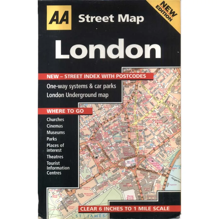
This wonderfully practical publication promises a clear six-inches-to-one-mile scale, allowing motorists, pedestrians and bewildered visitors to examine London’s extraordinary street network in considerable detail. Every twisting lane, major thoroughfare and suspiciously complicated junction appears with the confidence of an organisation that has spent generations helping British motorists recover from their own navigational optimism.
The cover proudly advertises a new street index with postcodes, an innovation that must have seemed positively revolutionary in 1997. No longer would finding an unfamiliar address require extensive guesswork and a telephone conversation with somebody who insisted that the destination was just past the old cinema that had been demolished in 1983.
Also included are one-way systems, car parks and a London Underground map, acknowledging the uncomfortable truth that although one might arrive in London by car, there are occasions when abandoning it altogether is the most sensible option.
For the tourist, the map offers guidance to churches, cinemas, museums, parks, theatres and places of interest, along with tourist information centres. In short, practically everything required to enjoy London, apart from a substantial quantity of money, comfortable shoes and the patience to tolerate several million other people attempting precisely the same thing.
Published in 1997, this map captures the capital at a particularly interesting moment. Tony Blair had just entered Downing Street, the Millennium Dome was still a future attraction, and the London Congestion Charge was several years away. The city was on the brink of enormous development, with neighbourhoods, transport infrastructure and familiar landmarks destined for significant transformation.
For local historians and collectors, an older street map offers a fascinating record of the city before nearly three decades of redevelopment, altered road layouts and changing commercial districts.
This 1997 AA London Street Map, offered in Good condition by Crappy Old Books, is an appealing acquisition for vintage map collectors, London enthusiasts, urban historians and anyone nostalgic for the days when finding an address involved consulting an index rather than shouting instructions at a mobile telephone.
A wonderfully detailed snapshot of London’s streets at the end of the twentieth century, when paper maps remained indispensable companions to motorists brave enough to tackle the capital.
And unlike modern satellite navigation, this one will never confidently tell you to make a U-turn in the middle of Piccadilly Circus.
It will simply sit there, silently judging your inability to work out where you are.
Keep browsing: See more Maps books Other books by AA
